Cardiff Central Station
Year
2015
The future developments around the station and the introduction of a public route through it create an opportunity for enhancing the connectivity of the area and embedding the station into the wider movement network.
Cardiff Central Station is a key pedestrian gateway into Cardiff. The area surrounding the station is currently constrained by the vehicle-oriented road network, railway infrastructure and poor quality of the public realm.
The Cardiff Central Masterplan represents an opportunity for Cardiff to raise its profile both within the UK and internationally.
The masterplan includes a new development by the BBC with a Central Square to the north of the station, a new Arena and public sector offices to the south and a new public route through the Central Station.
In order to assess the impact of these transformations on pedestrian movement patterns, Network Rail commissioned Space Syntax to develop a Pedestrian Movement Forecast Model.
One of the key benefits of the Space Syntax approach is to provide a ‘spatial profiling’ of a site in terms of its location, urban connectivity and multi-modal movement potentials.
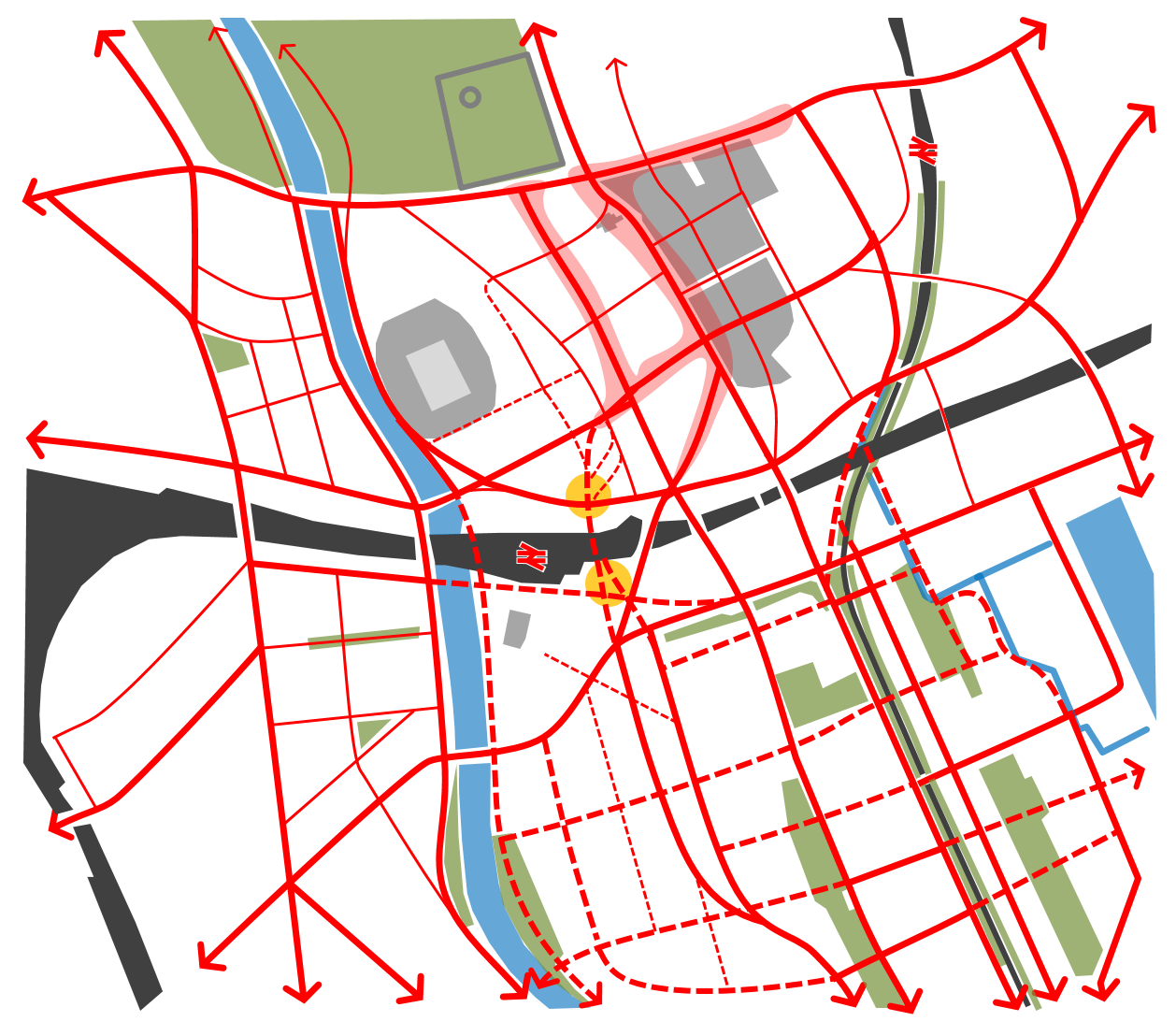
A Spatial Accessibility Model of Cardiff’s pedestrian movement network was first constructed to identify an initial set of opportunities and constraints for the site.
During the design development process, this model was used as a design tool to test the impact of the spatial layout changes proposed by different design options. The results of this testing process informed the development of the designs and influenced strategic development decisions by enabling an objective evaluation of proposed scenarios in terms of their likely impacts on movement patterns and, as a consequence, on commercial viability.
In a later phase of work, the Spatial Accessibility Model was linked to data on land use attraction, transport infrastructure and population density to create a Pedestrian Movement Forecast Model. This was used to translate future changes in layout, quantum of development and station demand uplift into quantified pedestrian footfall volumes.
Space Syntax’s modelling-led approach helped to shape the designs around a key north-south route that served not only to facilitate flows within the development but also to ‘stitch’ the site into its wider setting. The benefits of doing so were not only on commercial performance and land value uplift but also on pedestrian comfort, safety and ‘sense of place’.
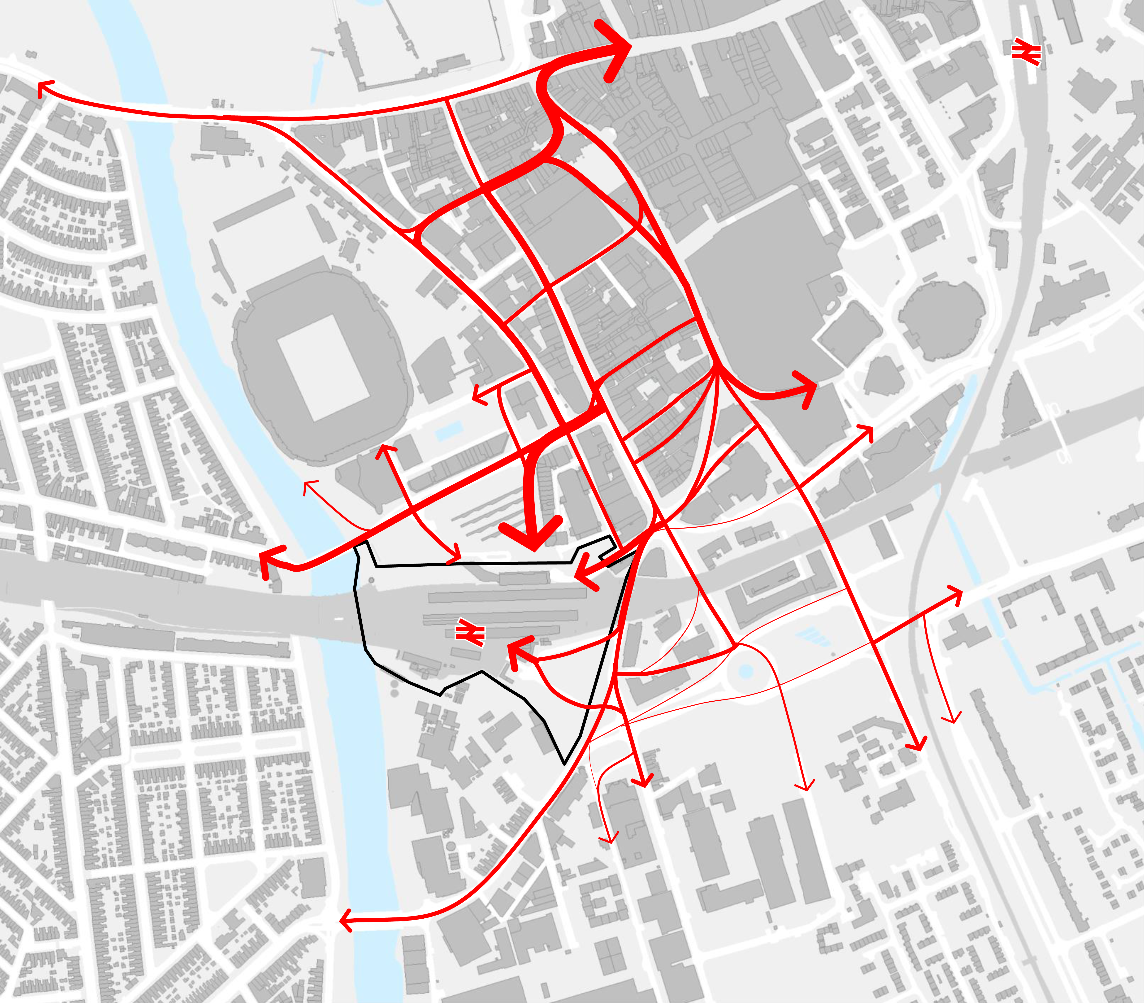
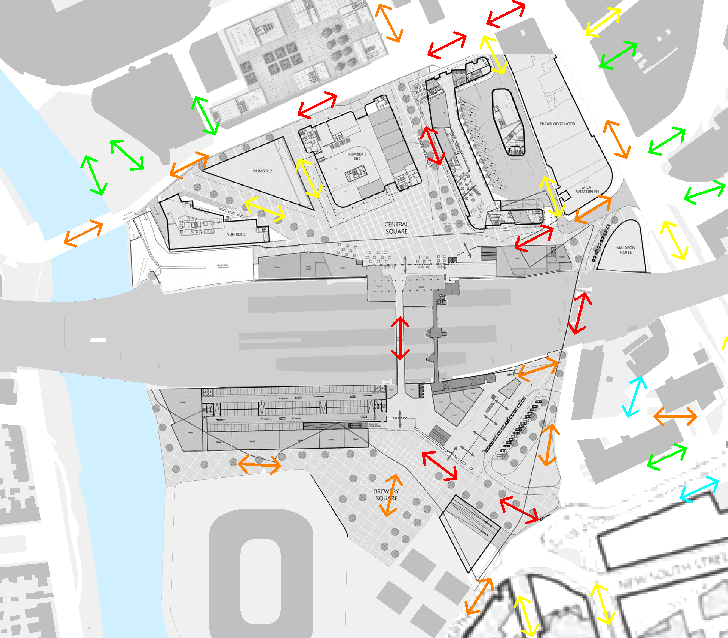
Diagram illustrating the difference in the activity levels between north and south of the station.