• Arbeitsplätze
  • Bildung
  • Building planning & design
  • Cultural buildings
  • Education
  • Einzelhandel
  • Gebäudeplanung & Design
  • Gesundheitswesen
  • Healthcare
  • Kulturelle Gebäude
  • Regional & urban plans
  • Regionale und städtische Pläne
  • Retail
  • Seite Entwicklungsstrategien
  • Site development strategies
  • Städtische Masterplan
  • Stadtplanung und-gestaltung
  • Straßen, Parks und öffentliche Räume
  • Streets, parks & public spaces
  • Transport
  • Urban masterplans
  • Urban planning & design
  • Verkehr
  • Workplaces
  • 交通建筑
  • 办公建筑
  • 区域与城市规划
  • 卫生健康建筑
  • 场地发展战略
  • 城市总图设计
  • 城市规划与设计
  • 建筑规划与设计
  • 教育建筑
  • 文化建筑
  • 街道、公园以及公共空间
  • 零售商业建筑
  • Case Studies

    OpenMapping GB

    Year
    2017

    Project Director
    Ed Parham

    A pre-processed spatial network model of Great Britain, published as an open dataset.


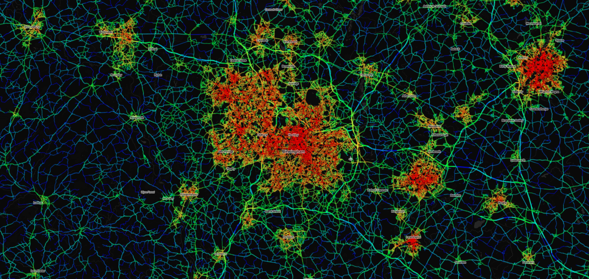
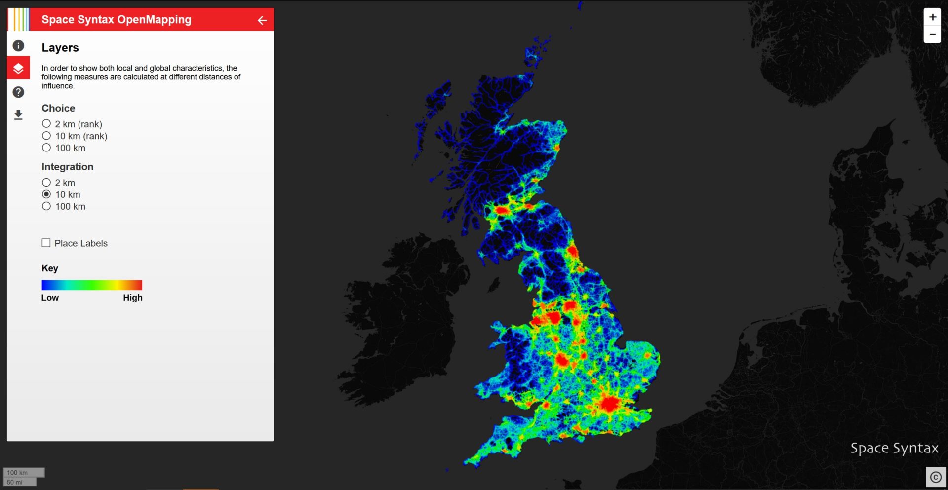
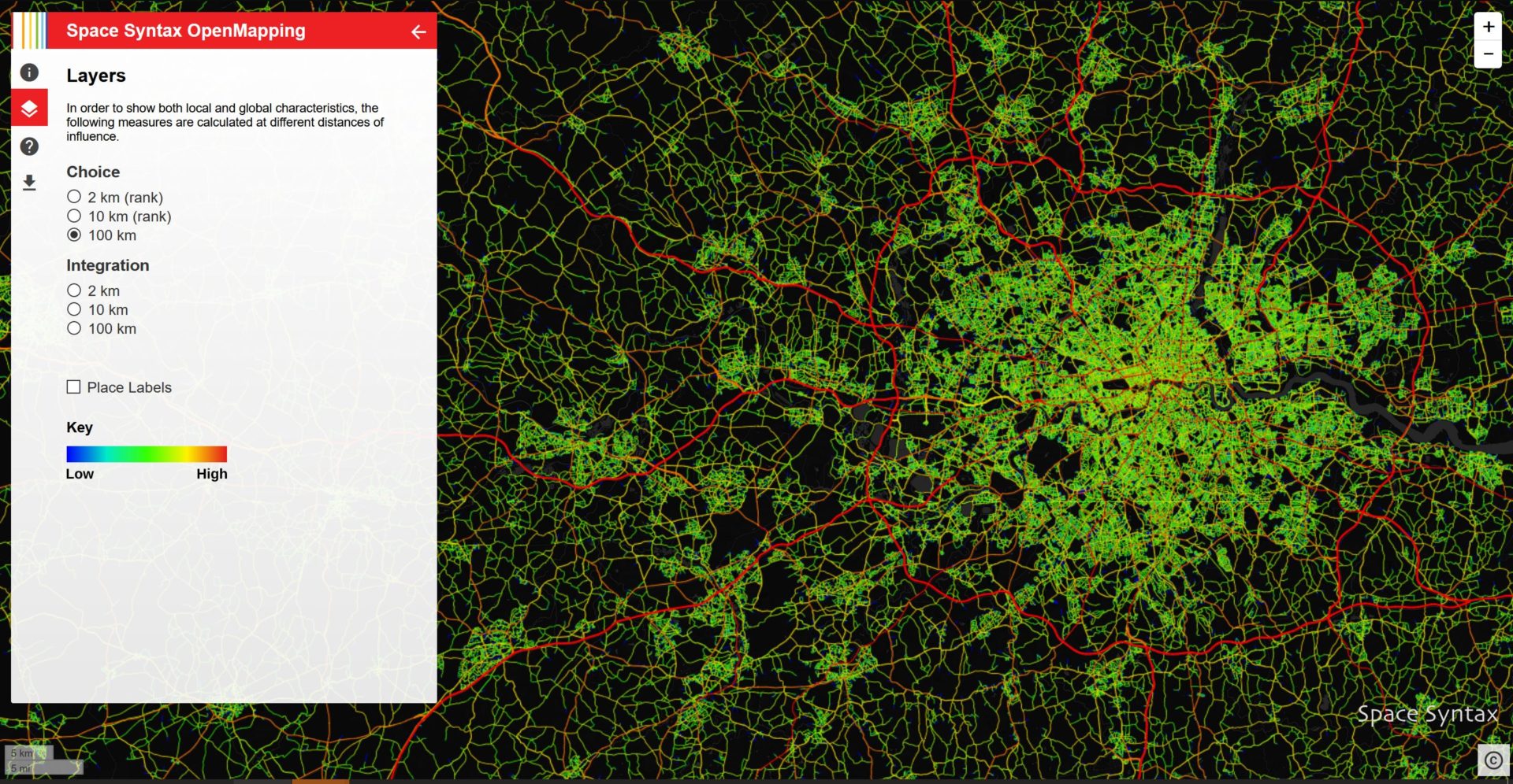
    Produced as part of the Company’s mission to disseminate the Space Syntax approach in ways that are affordable and accessible, the OpenMapping project provides data on two key ‘spatial accessibility’ measures commonly used in research and professional practice:

    Choice – the likelihood that movement will pass through any particular street

    Integration – the relative ease with which any location can be moved to from all other locations.

    These measures are calculated at three spatial scales:

    2km – helpful when assessing the walkability of an area

    10km – often used to assess vehicle movement patterns

    100km – a scale that typically reveals regional inequalities.


    Further information

    OpenMapping project website

    Space Syntax Digital page
    Details of our work in the development of digital modelling tools.