Space Syntax Toolkit
Year
2021
Project team
Abhimanyu Acharya
Stephen Law
Petros Koutsolampros
This release converts all tools from QGIS2 to QGIS3 and contains previously unreleased work, including major improvements to the Catchment Analyser and Road Centre Line cleaner. Several new tools are also included and the codebase has been cleaned up to unify various procedures. Initial, automated testing procedures have been created so that outputs are consistent across versions, and tools are included to document code for future reference.
Updated tools
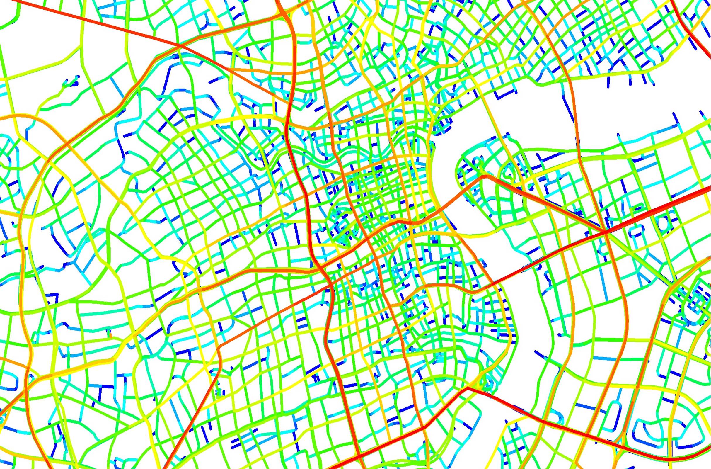
Graph Analysis – connects with depthmapXNet to carry out graph analysis directly in QGIS. The tool also contains various processes for verifying the validity of spatial models eg checking for null and empty geometries.
Attributes Explorer – allows for the examination of various map attributes and the painting of various features using known and new colour scales.
Catchment Analyser – undertakes catchment analysis to identify which locations are within a specific distance from a given set of points.
Gate Transformer – moves, rotates and scales data collection ‘gate’ lines.
Road Centre Line Cleaner – provides a general verification and cleanup tool for road-centre line maps.
Urban Data Input – semi-automates processes for inputting urban data.
Additional tools
Network Segmenter – breaks lines in axial maps into segments and performs various other validation procedures to aid in later analysis.
Drawing Tool – helps in drawing segment and axial maps by enabling predefined snapping settings.
Space Syntax Toolkit development team
Space Syntax staff
Abhimanyu Acharya, Stephen Law, Petros Koutsolampros.
Former Space Syntax staff
Ioanna Kovolou, Laurens Versluis.
The Space Syntax Toolkit was originally developed for Space Syntax by Jorge Gil.
Download
Go to the Space Syntax Toolkit page on GitHub or install via QGIS plugins.
