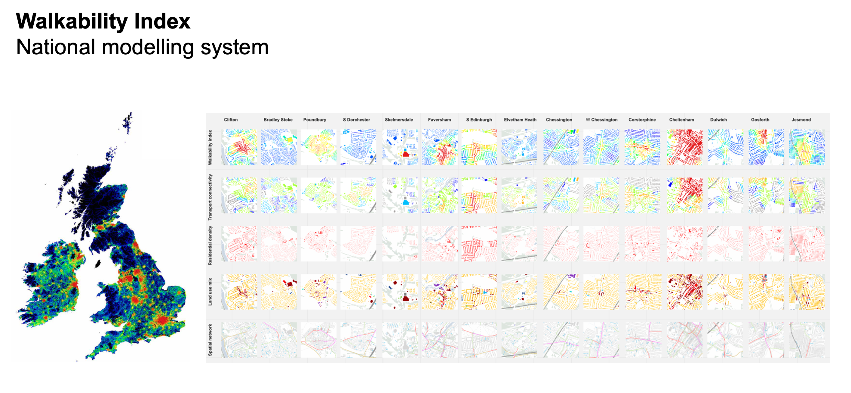
Walkability Index
Year
2020
Project team
Ioanna Kolovou
Po Nien Chen
Partners
The Prince's Foundation
Knight Frank
Smart Growth Associates
The location of everyday land uses – shops, offices, schools and healthcare facilities – has important effects on our movement choices: whether we reach them by walking or cycling, catching a bus or going by private car.
Sometimes there is no choice: low density, monofunctional housing estates create car dependence. This is not only harmful for the environment but damaging to our mental and physical health. Car dependence influences obesity and loneliness. In contrast, walkable places are healthy and sociable places.
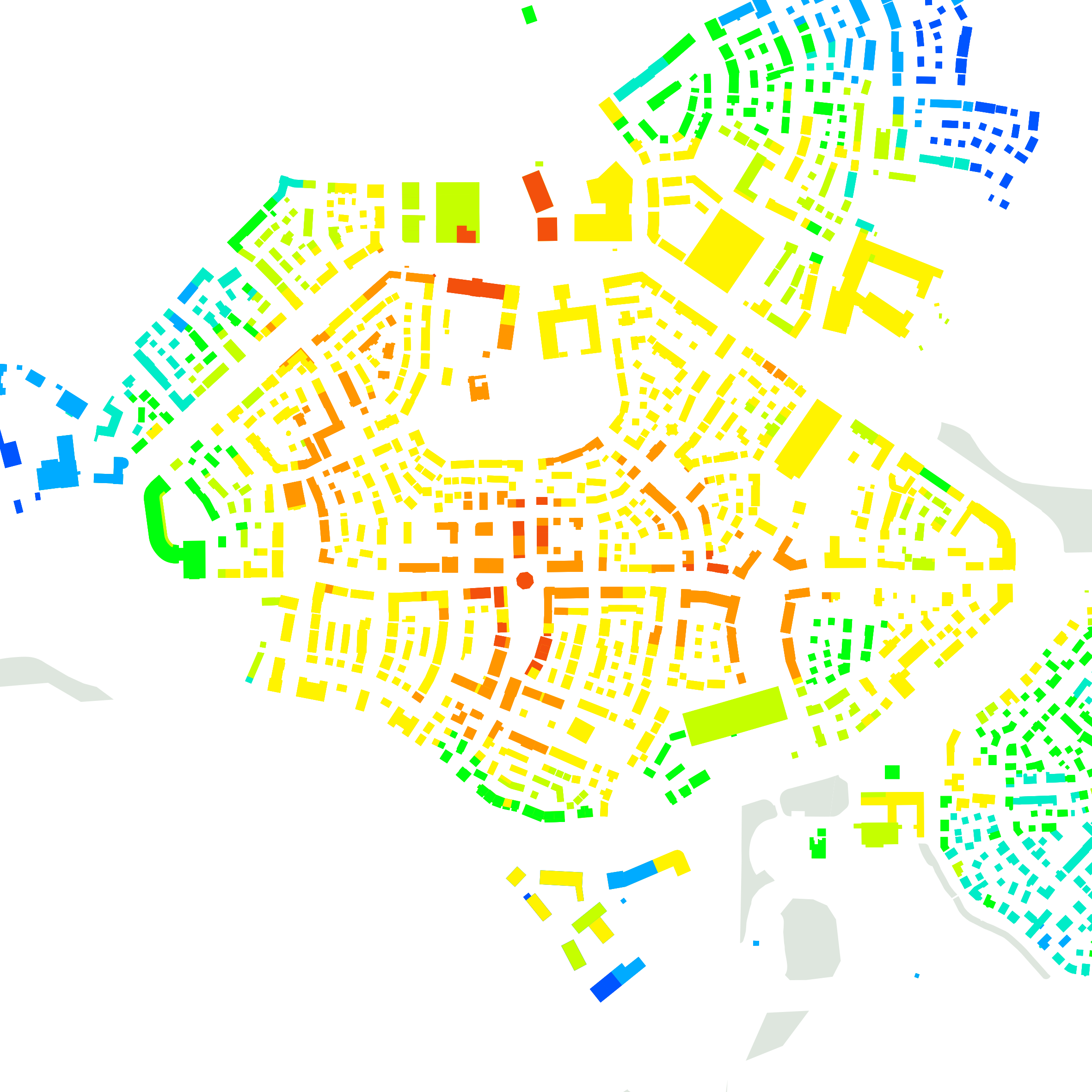
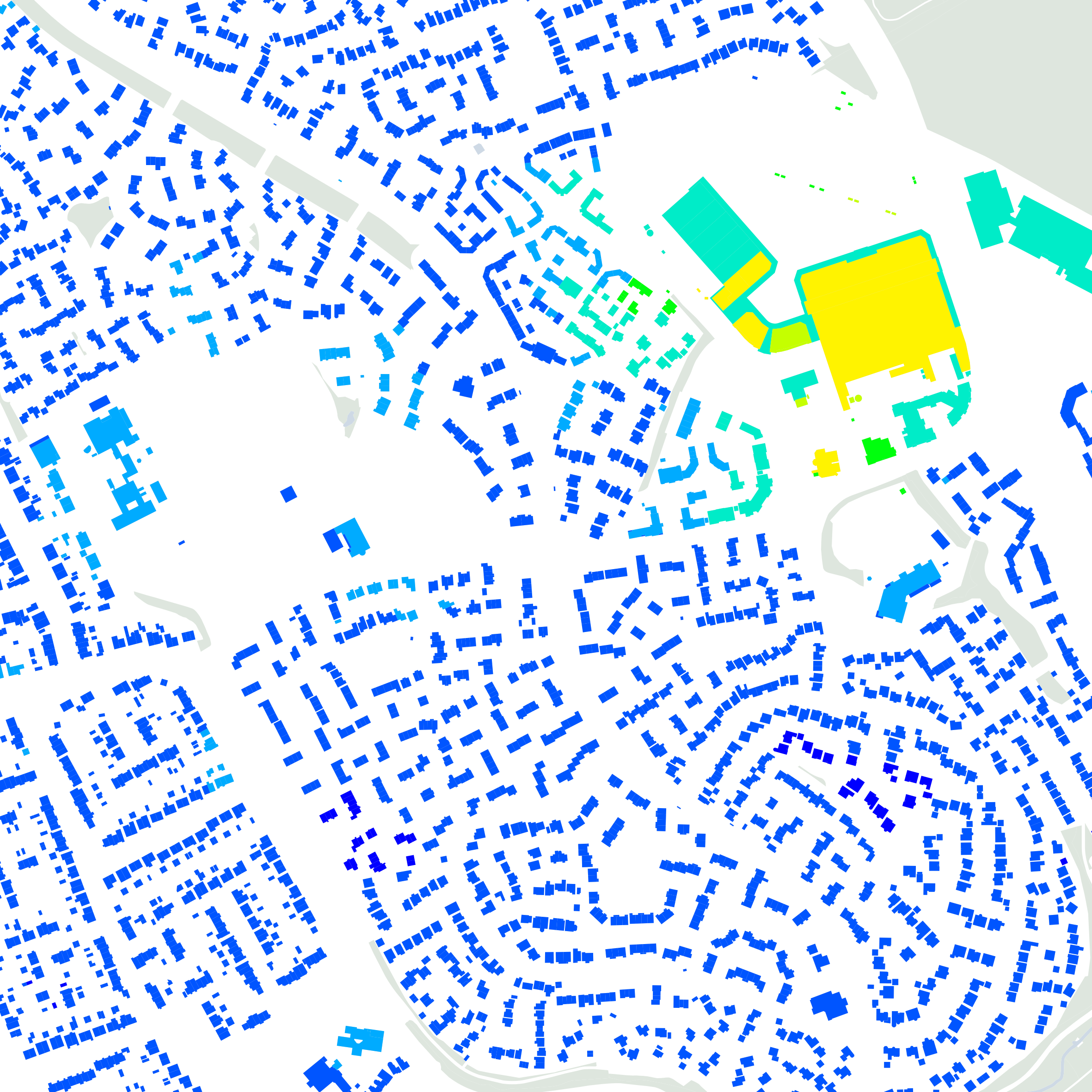
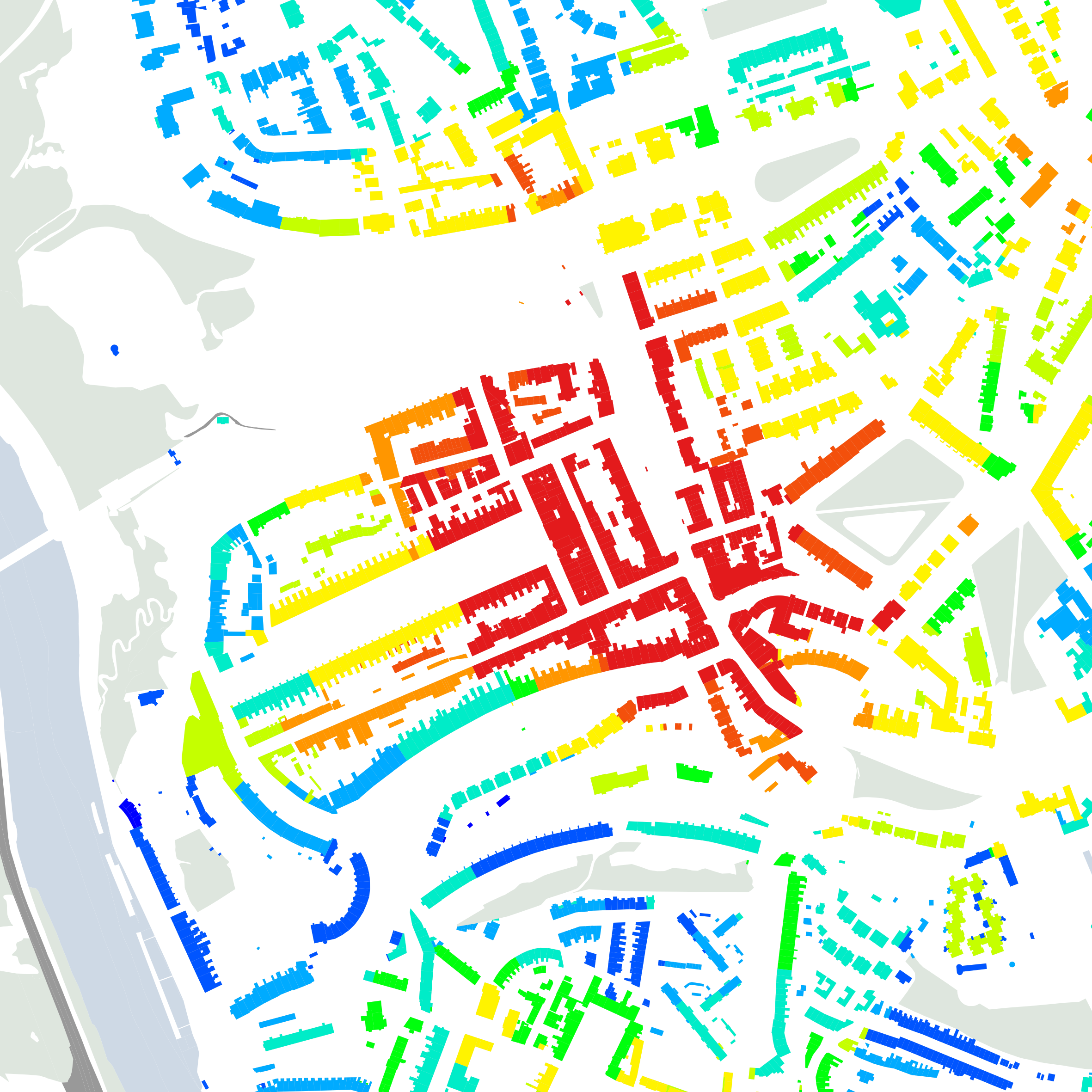
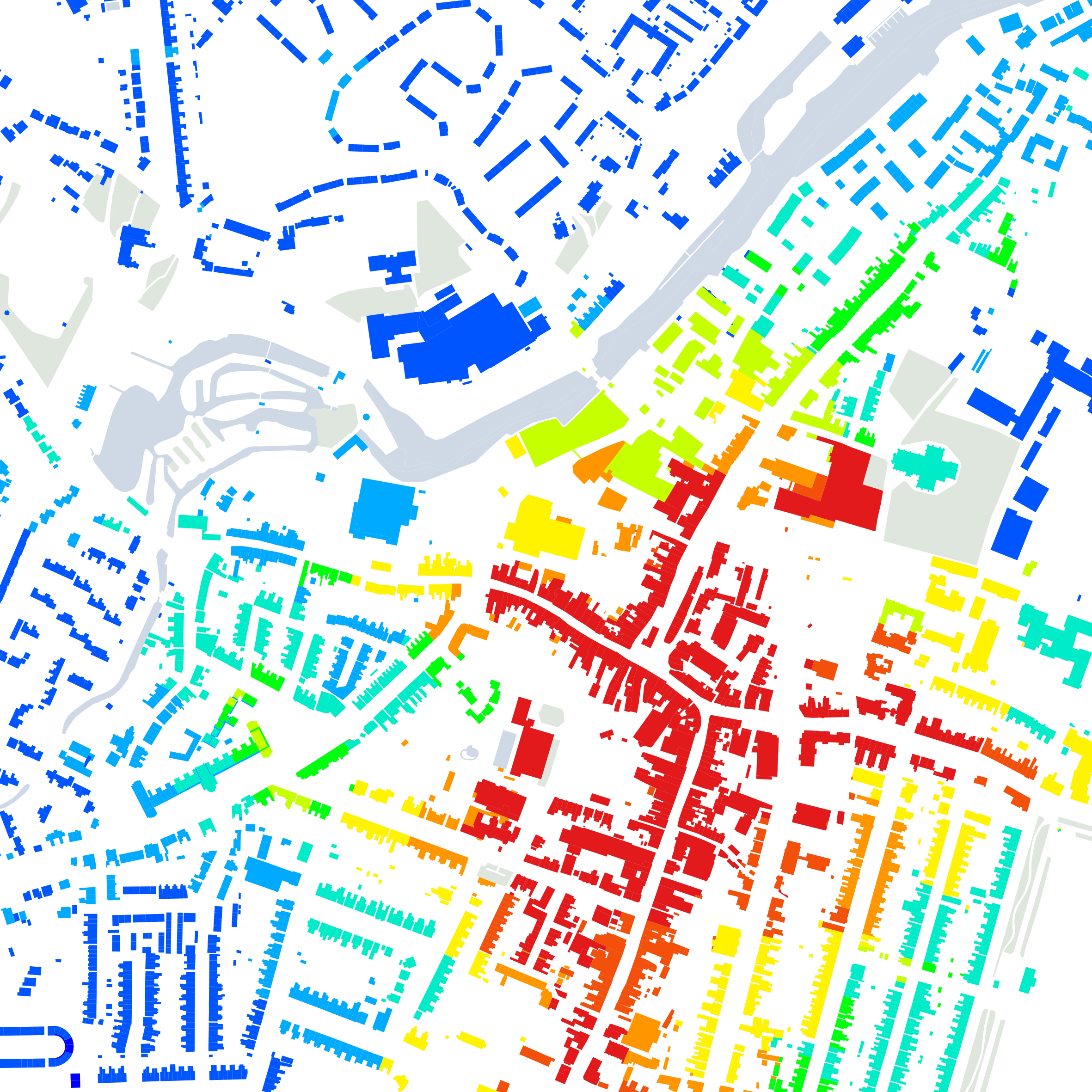
Computer modelling is used to map everyday, non-residential uses and then measure how far they are from people’s homes. This is particularly influenced by the connectivity of the street network and the size of urban blocks. Is a route simple and direct or is it labyrinthine? Are there lanes and cut-throughs that make it easier to walk from A to B? Research shows that block sizes are typically smaller in thriving urban centres and larger towards the edges. This means there is greater ‘permeability’ around the shops and markets at the heart of settlements – where more people are – and less around the residential edges: a ‘natural’ relationship that ensures that all routes are continuously animated by human life, with a buzz towards the commercial centre and gentler levels of animation towards the edges.
The Walkability Index heat maps describe the degree to which newer settlements have succeeded, or not, in emulating the lessons of historical places such as Clifton. By analysing each building in turn, it is possible to identify how many different everyday land uses are within a 5-minute walk. Poundbury scores highly, South Dorchester and Bradley Stoke less so.
Space Syntax’s Walkability Index database covers every building in Great Britain. It allows existing places to be ‘footprinted’ so that new proposals can be objectively tested in terms of whether they deliver car dependence – with its associated problems – or walkability – with the social, economic and environmental values that walkable places create.
See publication
Walkability & mixed-use: making valuable & healthy communities
A report by The Prince’s Foundation with Smart Growth Associates, Knight Frank and Space Syntax, with a foreword by HRH The Prince of Wales.
Further information
Space Syntax Digital page
Details of our work in the development of digital modelling tools.
Space Syntax Consulting page
Details of our services supporting public & private sector clients in the creation of urban planning & building design strategies.

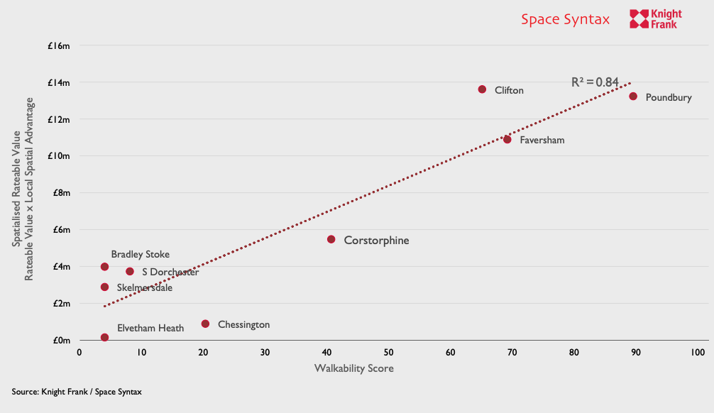
More walkable places generate higher rateable values.