UK Integrated Urban Model
Year
2021
Urban settlements – villages, towns and cities – are complex combinations of physical form, infrastructure systems, human networks and economic activities. Physical changes may have unexpected impacts on these systems, and on the day-to-day functioning of the city.
To de-risk the unexpected impacts of planning or large scale design, Space Syntax has developed the “Integrated Urban Model” (IUM) approach. IUMs allow existing social, economic and environmental conditions to be described quantitatively and objectively. They provide tools that can be used during policy development and strategic planning, setting consistent baselines to test the impacts of future scenarios.
An IUM is a digital spatial model that combines publicly available datasets on movement systems, land use patterns, population census and employment. Additional datasets, for example on physical and mental health, can be geo-located and added if required.
The UK Integrated Urban Model has been designed to provide straightforward outputs that address everyday questions facing people living in urban settlements:
– how many jobs can I get to within, say, 30 minutes of where I live and what mobility options do I have to reach them?
– can I walk to a decent school or doctor?
– am I close to shops, cafes, parks and other open spaces?
The model provides analysis of the impacts of transport infrastructure decisions, housing growth numbers and land use allocations. It can also be used to set indicators such as land use mix and employment accessibility standards as part of a Design Code exercise.
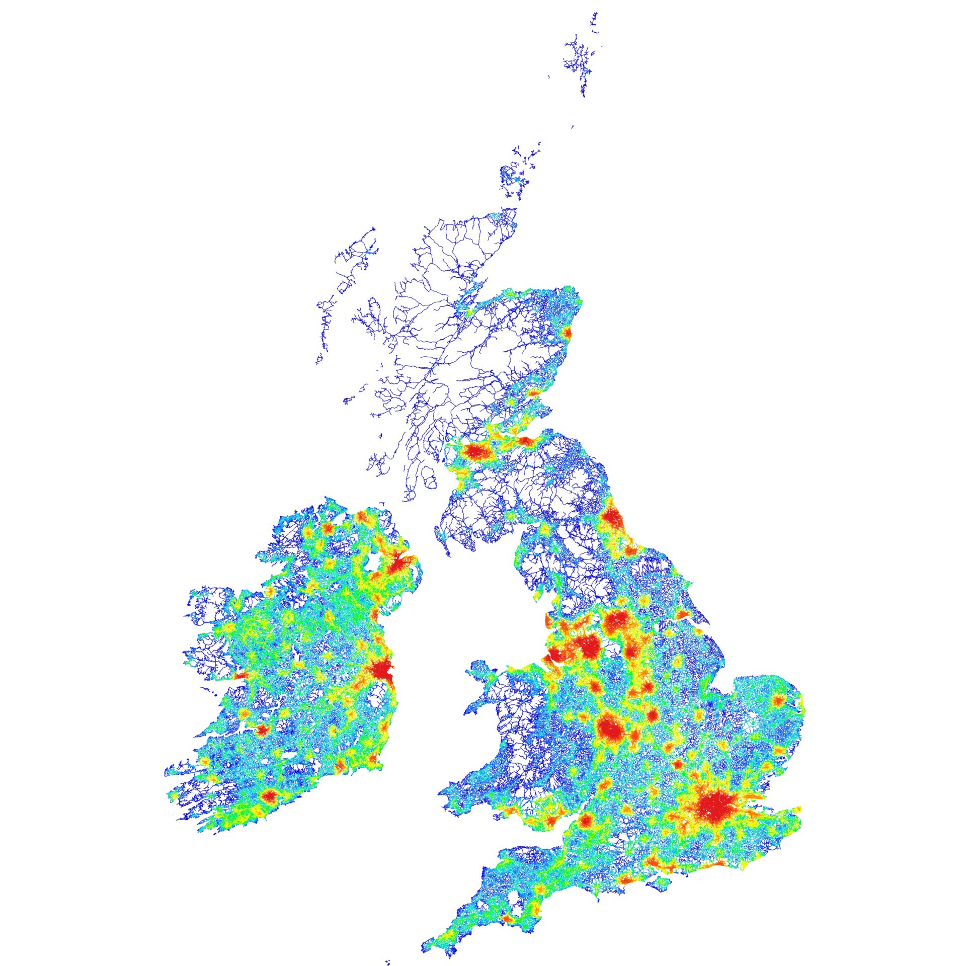
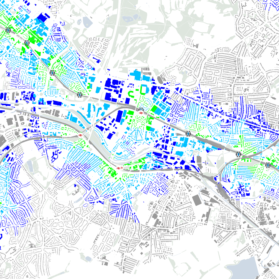
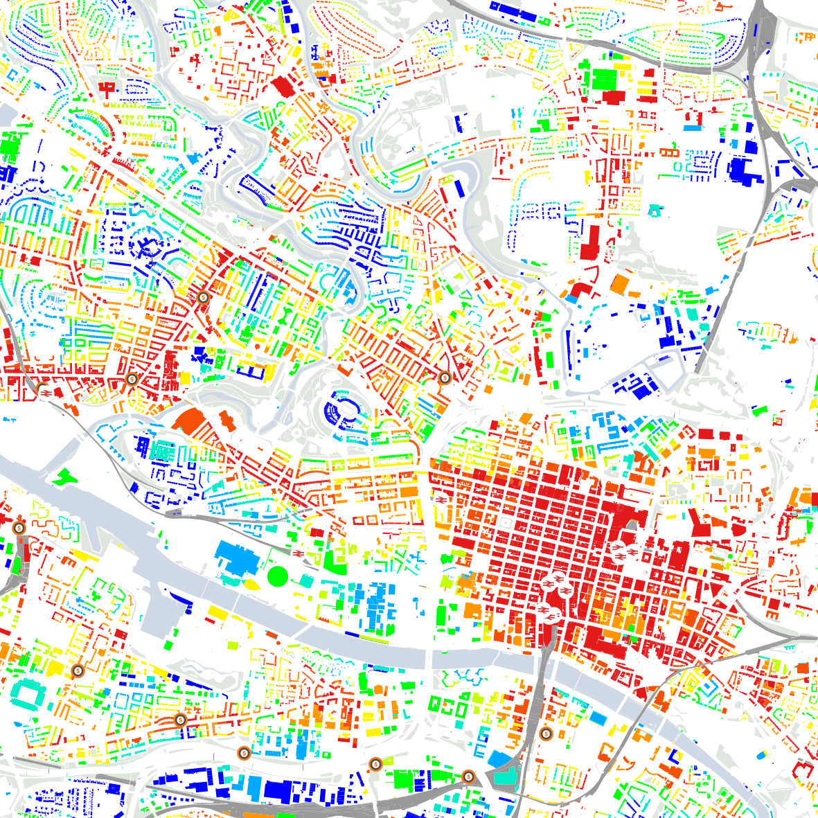
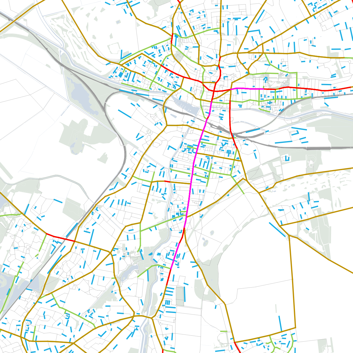
A key output of the IUM is the Walkability Index, which measures the number of land use options available on foot from each building in the UK. Other measures include a Public Transport Index – describing the accessibility of every building to bus, metro and rail options – and a Street Character Index – describing the mobility characteristics of each street segment in terms of the likelihood that they will be used for long-distance or short-distance journeys.
The UK Integrated Urban Model has been developed to make the following contributions to planning and design projects:
– provide quantitative analysis of existing and future scenarios
– enable the impact of population or employment growth to be measured before spatial design proposals exist
– support the development of infrastructure or public transport proposals through an evidence-based and iterative process
– measure and compare the impact of scenarios against each other, or against an existing condition
– inform option selection decisions by demonstrating the impact of proposals on urban indicators.
Further information
Space Syntax Digital page
Details of our work in the development of digital modelling tools.
Space Syntax Consulting page
Details of our services supporting public & private sector clients in the creation of urban planning & building design strategies.
Email us
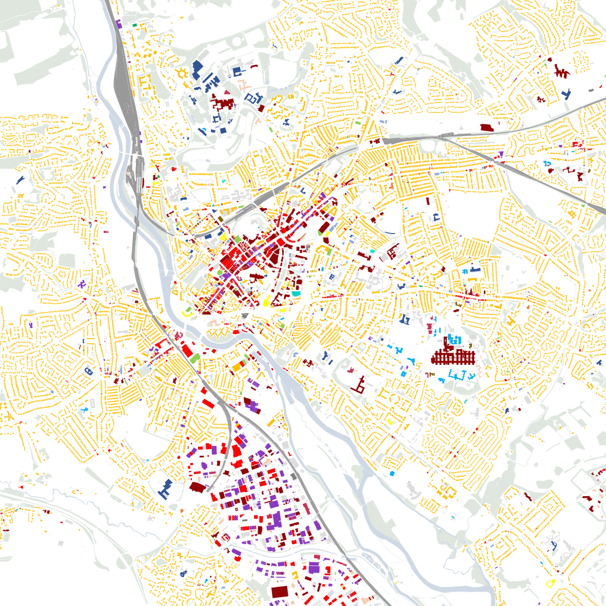
Land Use Mix
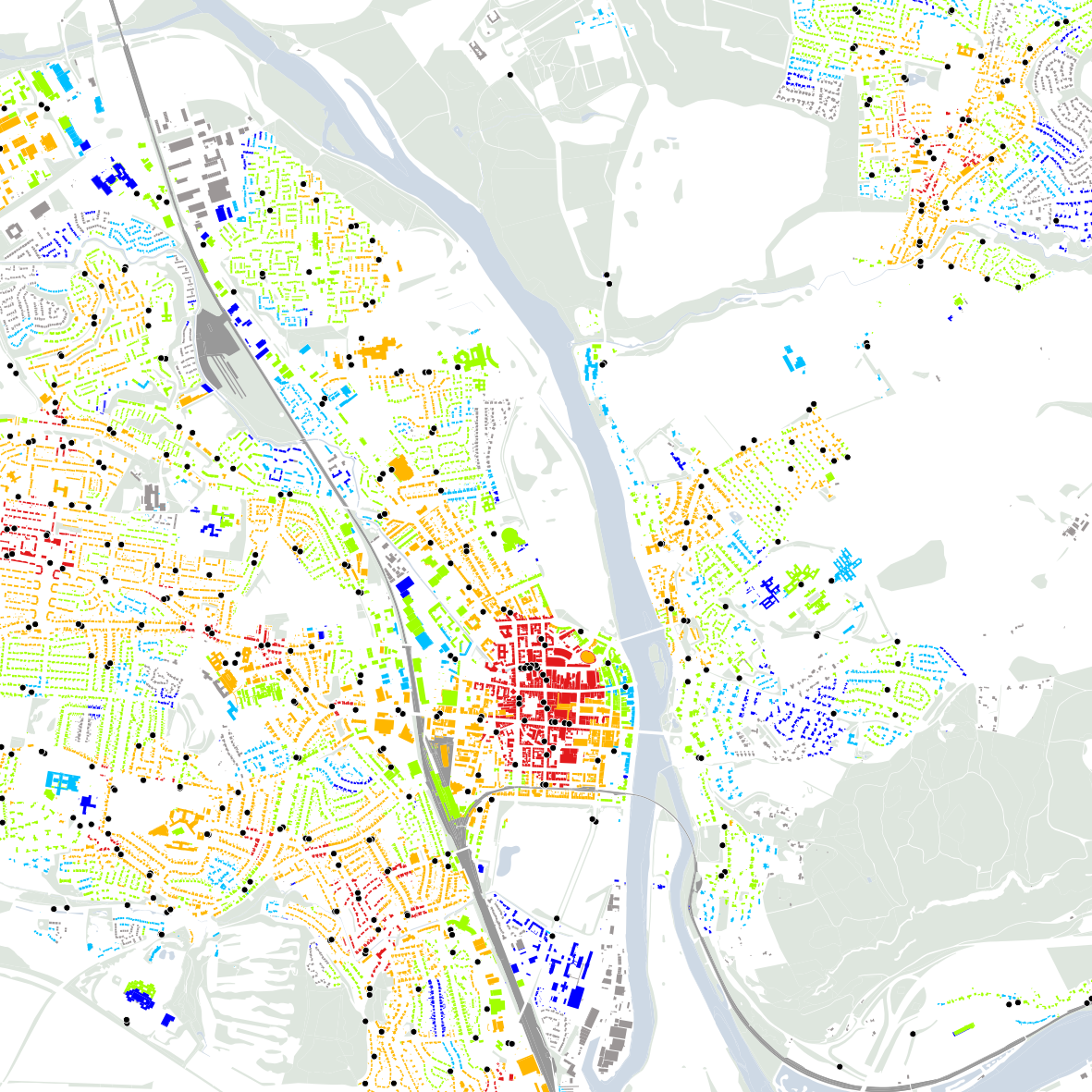
Bus Stop Accessibility
Metro/Rail Station Accessibility
Public Transport Index
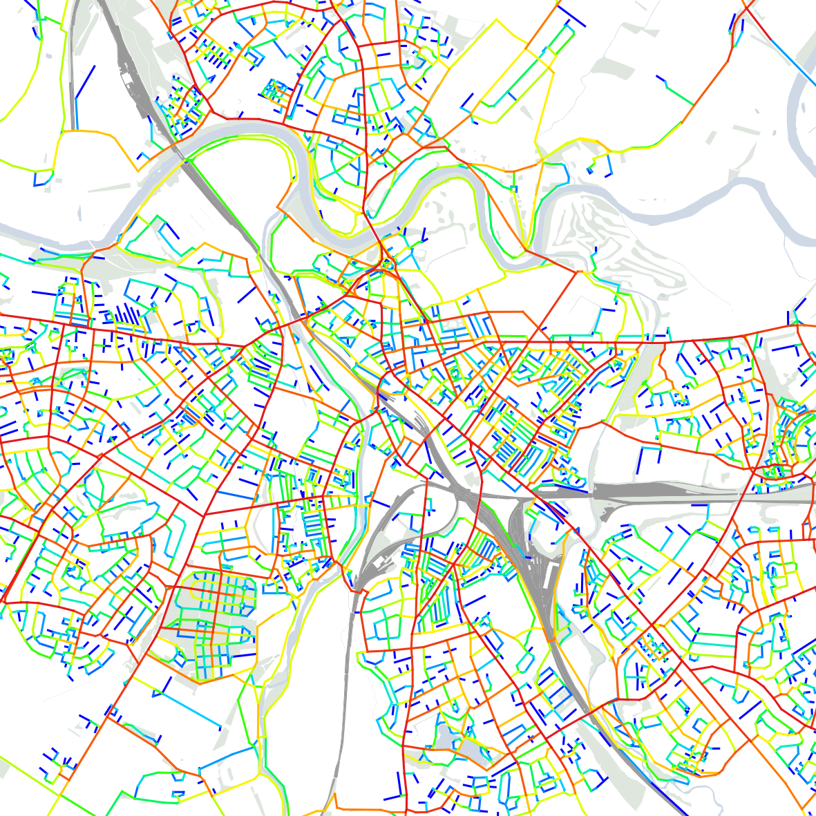
Local Spatial Accessibility
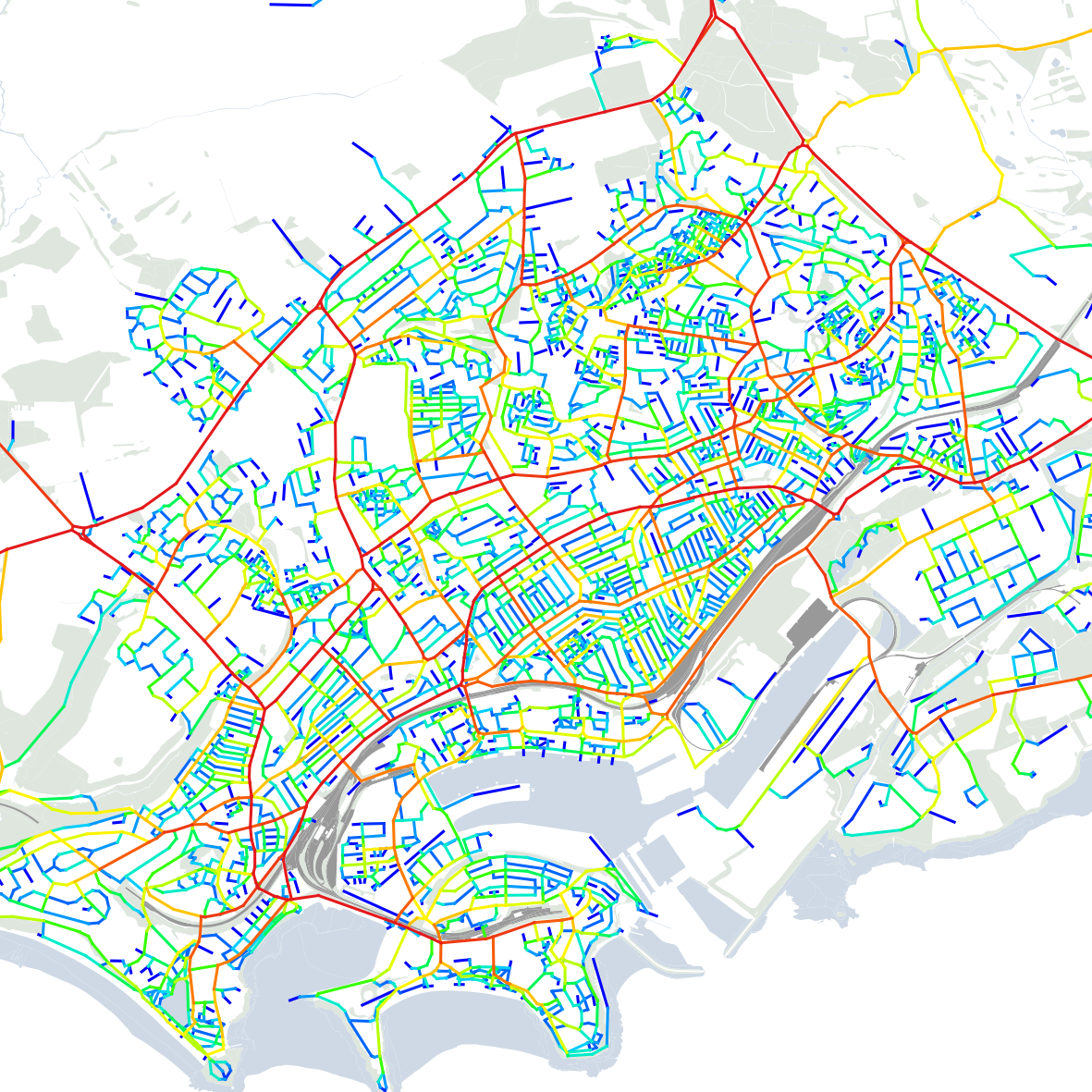
Global Spatial Accessibility
MultiScale Spatial Accessibility
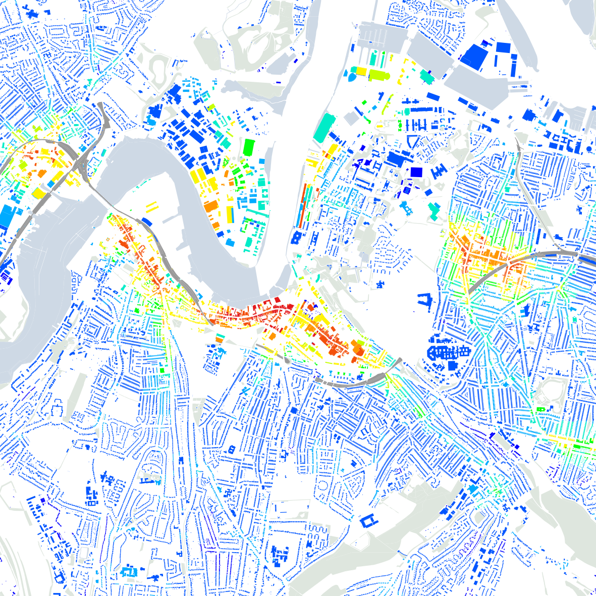
Walkability Index
